Terrain and Line of Sight
Welcome back to Decision Point.
In the previous diary, I looked at how players issue orders and how subordinate formations carry them out. This diary focuses on the ground those formations are operating on, how subordinate commanders use it, and the tools available to understand it.
Terrain affects where units can move, what they can see, and how well they survive contact. A position that looks suitable on the map may have a restricted field of view. A quick route to an objective may also leave a formation exposed throughout its approach.
The aim is to make assessing the ground a practical part of planning.
Real World Terrain in Three Dimensions
Decision Point uses real world terrain represented in three dimensions. Elevation matters even when the battlefield is viewed from above: ridgelines interrupt observation, valleys create covered approaches, and small changes in height can determine whether a position overlooks an objective.
Moving a little further up a slope may open a useful field of view, while remaining behind the crest may help keep a reserve out of sight. The ground between two units matters just as much as the distance separating them.
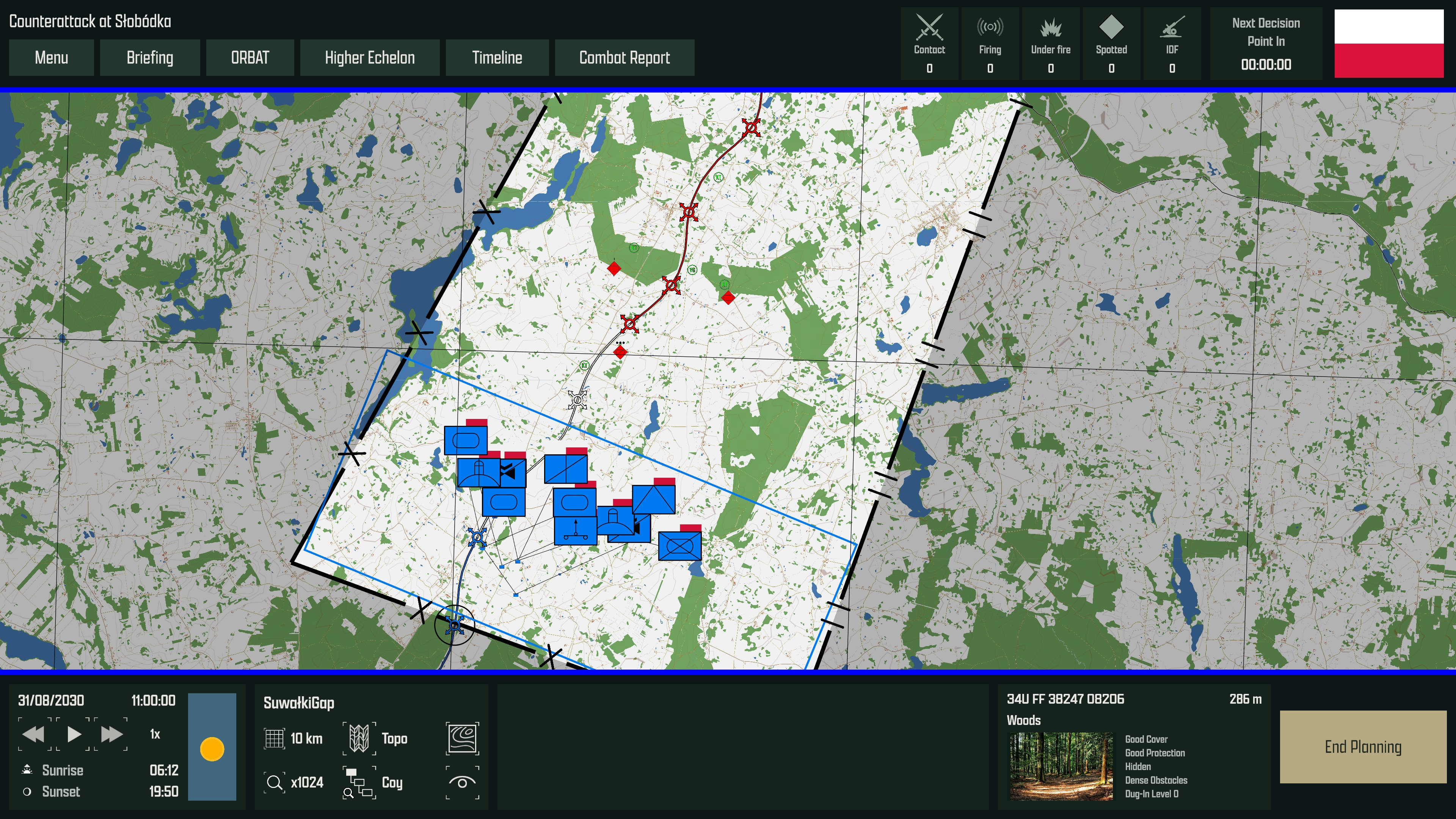
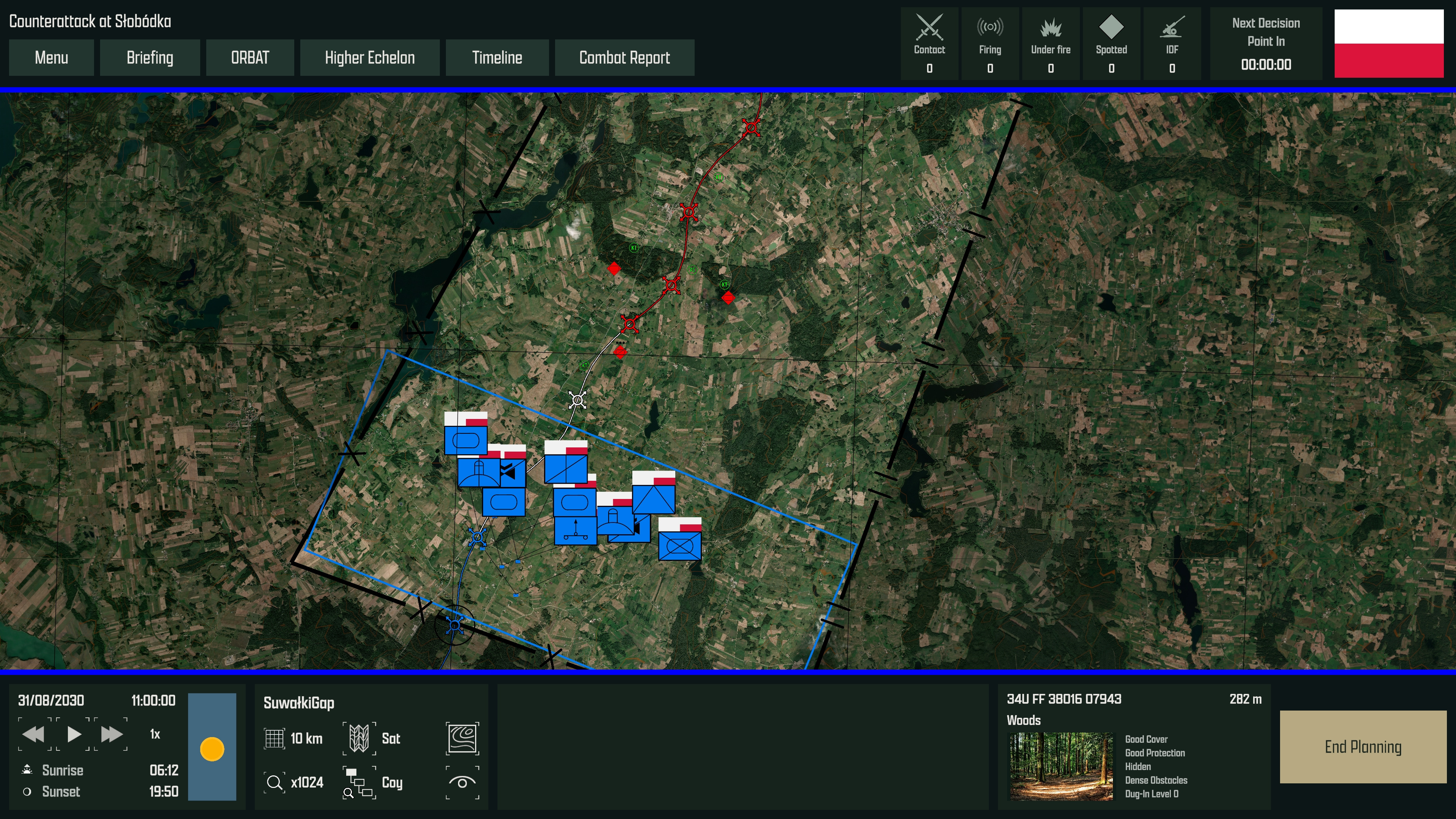
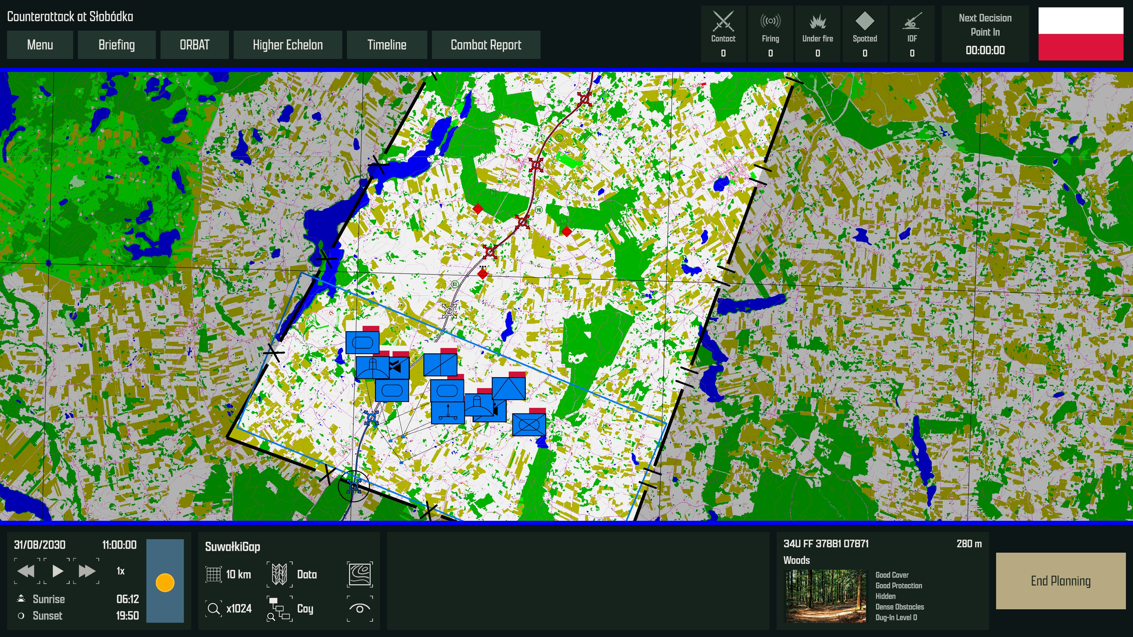
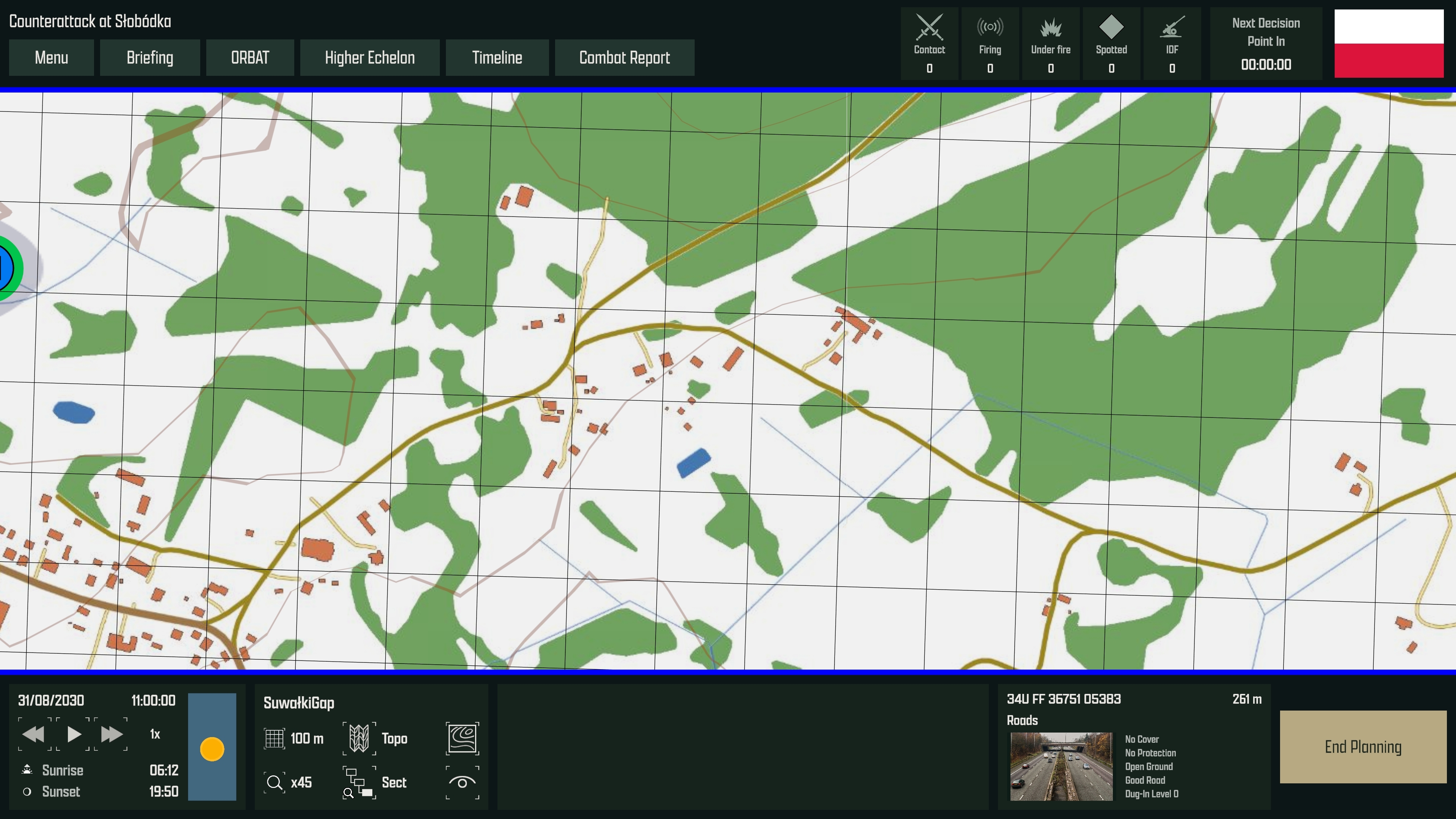
Players can switch between topographic mapping, satellite imagery, and a terrain classification view to examine the same area in different ways.
The game includes vast terrain areas in Poland and Ukraine, giving formations space to manoeuvre and allowing the wider geography to influence the battle.
Understanding the Ground
The landscape is classified into terrain types, including woods, buildings, roads, fields, cropland, and scrubland. These classifications describe how the ground behaves in the simulation.
Each type has characteristics that affect:
- Concealment: how well it helps a unit avoid detection.
- Protection: how much cover it provides during combat.
- Going: how easily units can move through it.
- Height: the additional obstruction provided by features such as woods and buildings.
Cropland, for example, can help conceal a unit while offering relatively little protection from fire. A road provides good going but leaves a formation more exposed. Woods can provide concealment and protection, while restricting observation and slowing movement. Dense woodland can prevent units deep inside it from seeing out or being seen from outside.
The effect also depends on the unit. Low vegetation offers less concealment to an armoured vehicle than to infantry.
Slopes directly affect movement. Climbing a slope reduces movement speed, with steeper gradients imposing greater penalties. Tracked vehicles, heavy and light wheeled vehicles, and infantry respond differently, so the same hillside can present a different movement problem for each.
How Subordinate Commanders Use Terrain
These characteristics are used by the AI subordinate commanders when turning the player’s intent into a practical plan.
During planning, subordinate commanders develop their scheme of manoeuvre to the objective, selecting routes and tactical positions suited to their orders. They consider concealment, going, protection, and the movement characteristics of their units, while working within the player’s routes and control measures.
The best position depends on what the formation has been ordered to achieve. A Support-by-Fire intent needs a position from which it can engage the intended target. A Screen intent places greater emphasis on concealment and observation. A defensive formation considers protection, fields of fire, and existing dug-in positions. Ground that is suitable for one task may be unsuitable for another.
This gives the terrain a role in both the planned approach and the final deployment. The player defines the intent and the framework of the order, while subordinate commanders use their assessment of the ground to develop the detail within it.
A Changing Battlefield
Terrain can change through defensive preparation, combat, and the movement of units.
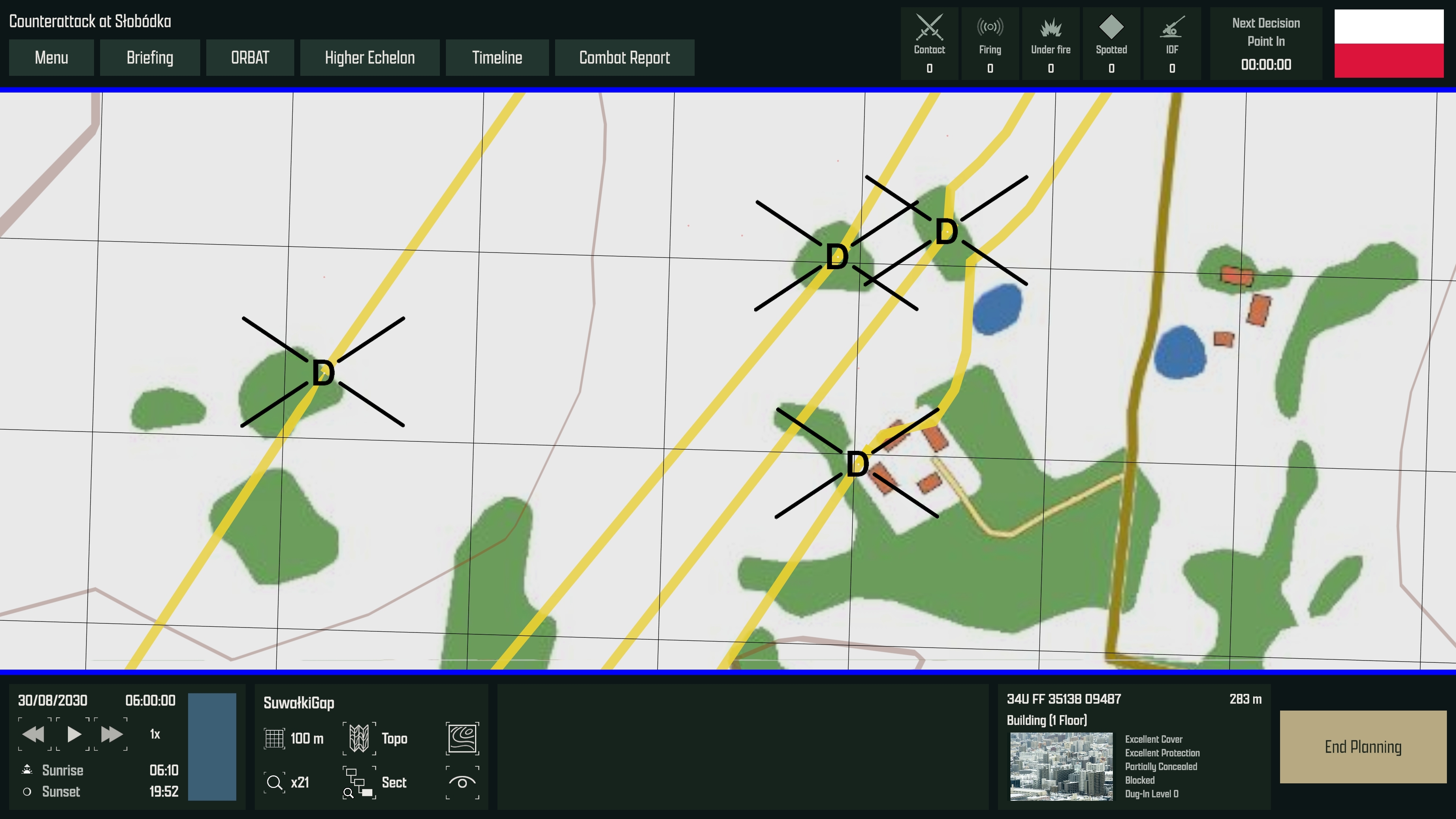
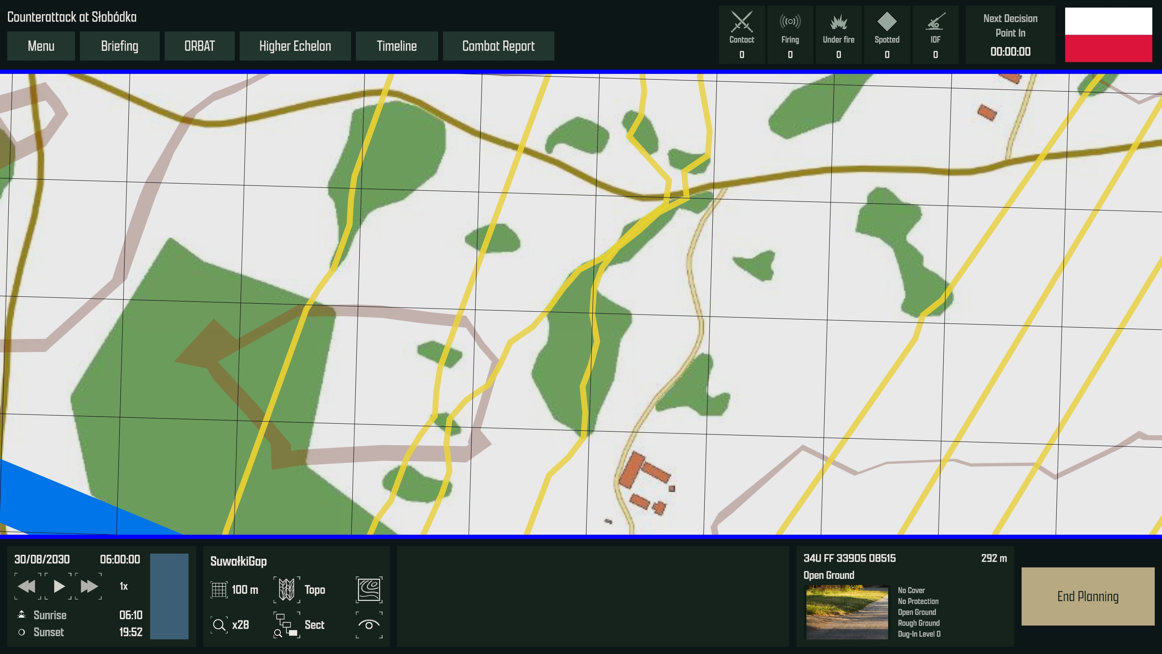
Dug-in areas have six levels of preparation and can improve over time while occupied. Their benefits are tied to the position, so a unit that moves away gives up that protection. Another unit occupying the same ground can make use of the existing position.
For infantry, digging in improves survival under fire and reduces the effects of blast and suppression. This gives the defender a reason to prepare early, and the attacker a reason to consider how long the enemy has had to establish a defence.
Explosions can leave craters, damage roads, and turn buildings into rubble. Crater size varies with the explosion, and craters can provide a degree of protection to units occupying them. Heavy armoured vehicles can also turn smaller buildings into rubble as they drive through them.
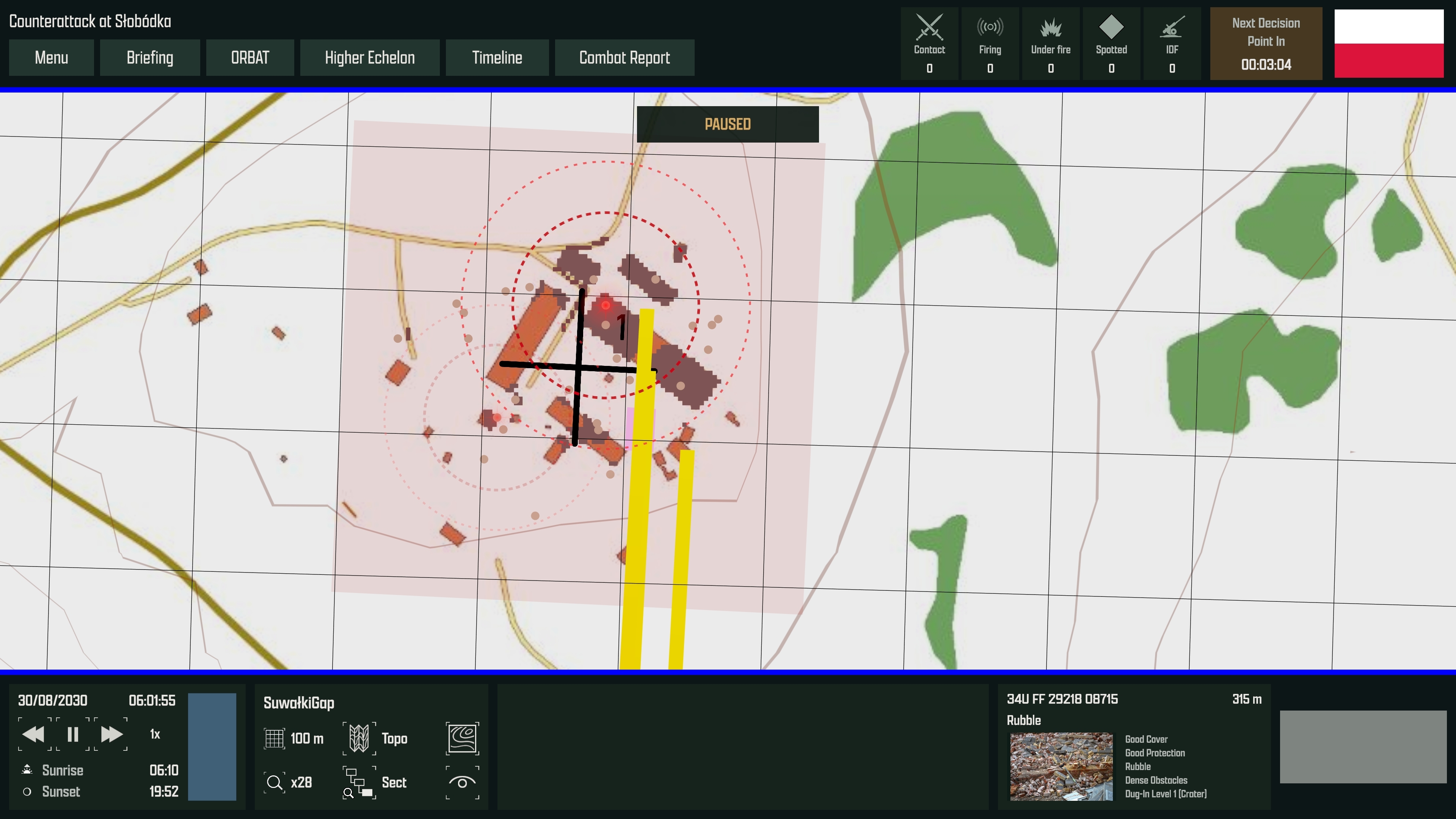 Vehicles leave traces of their movement. Tracked vehicles and heavy wheeled vehicles can create trails across fields and scrubland, while vehicles passing through cropland flatten it. These trails and flattened crops can reveal where vehicles have moved, particularly to drones observing the ground from above.
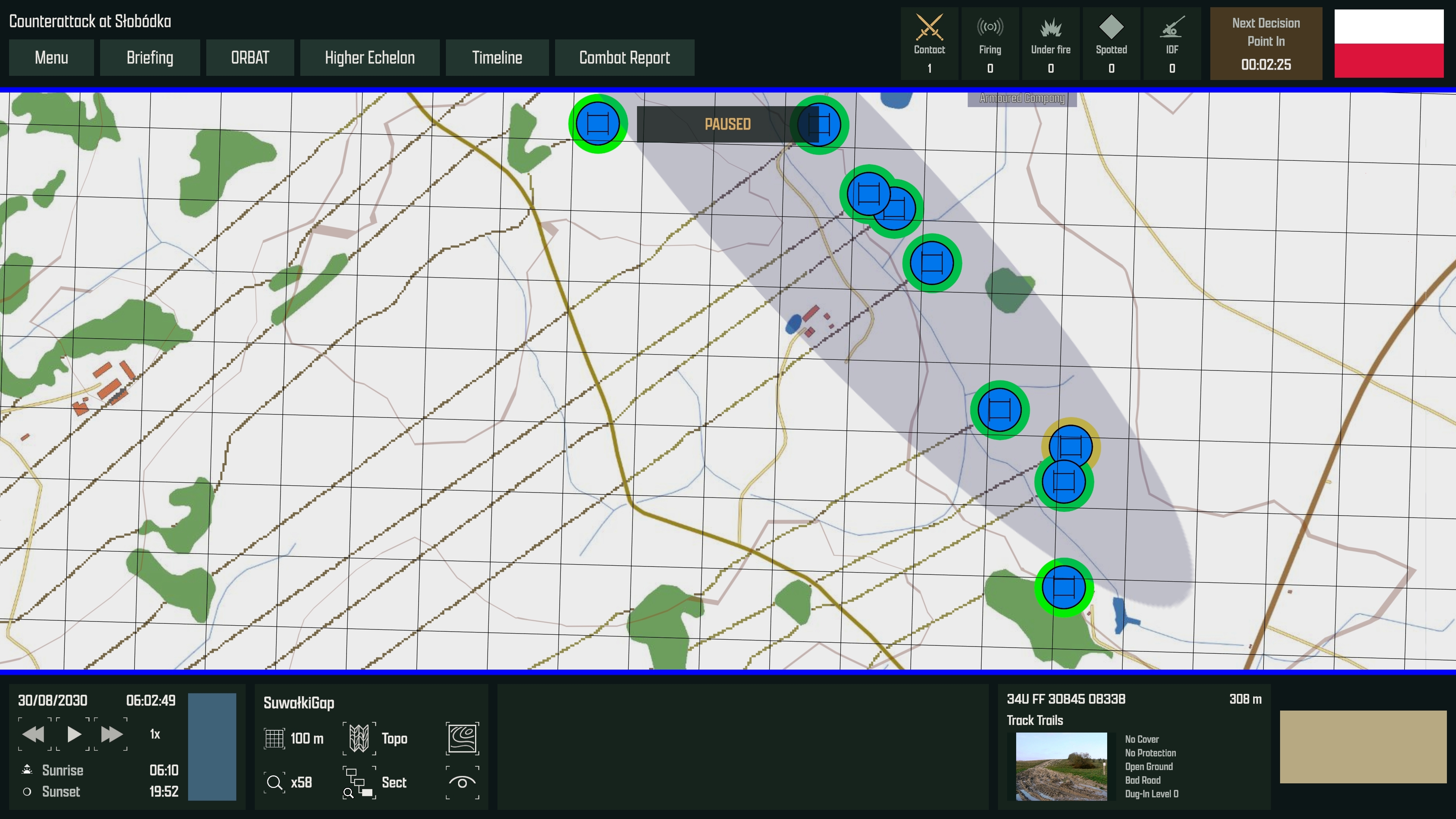 Changes to the terrain also affect the ground’s characteristics. A damaged road offers poorer going, while rubble changes the cover and obstruction previously provided by a building.
As the battle develops, positions and routes that were suitable at the start may need to be reassessed.
Time of Day
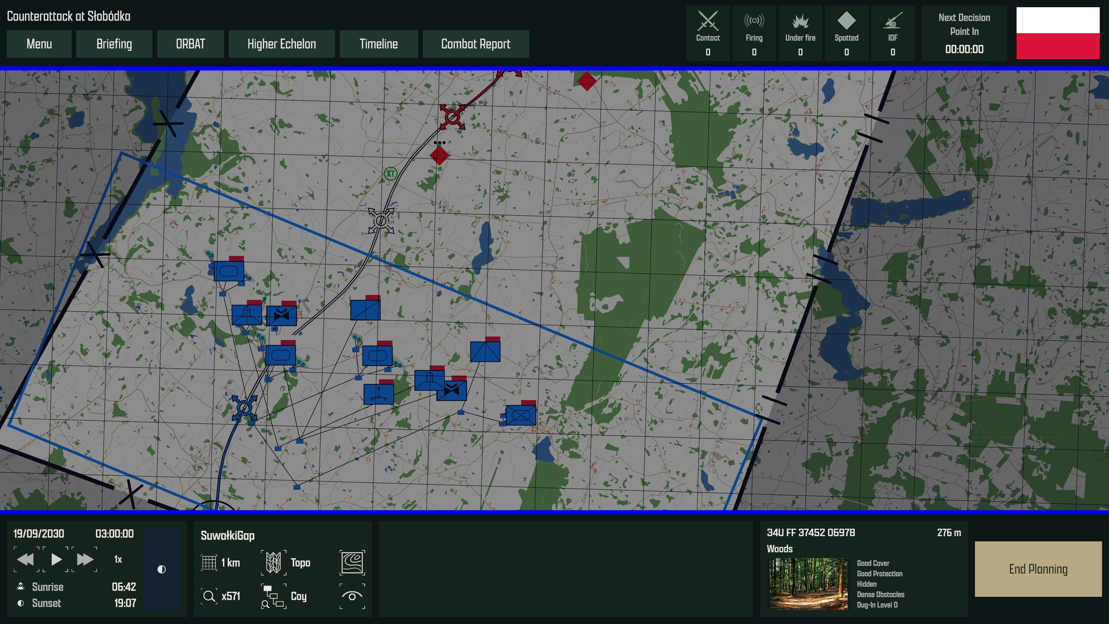
Conditions also change as time passes. Decision Point has a continuous day and night cycle driven by astronomical calculations using the scenario’s date, time, and geographical location.
The positions of the Sun and Moon are calculated, allowing sunrise, sunset, and twilight to follow the conditions for that place and date. Moonlight takes account of both the lunar phase and the Moon’s height above the horizon. A full Moon below the horizon does not brighten the battlefield.
As darkness increases, visual detection becomes more difficult. A position that provides useful observation during daylight may become much less effective after dusk for a unit relying on ordinary sights.
Units equipped with night vision sensors can maintain more effective observation as the light falls. The capability of those sensors matters: units with better night vision retain a greater ability to detect targets in darkness. Thermal imaging also helps units operate in these conditions, making the equipment available to each side an important part of planning a night operation.
Timing therefore matters. A movement that begins under cover of darkness may still be underway at dawn, changing the conditions before the formation reaches its objective.
Reading the Terrain
Several heatmaps help players assess ground that may be difficult to interpret from the normal map view.
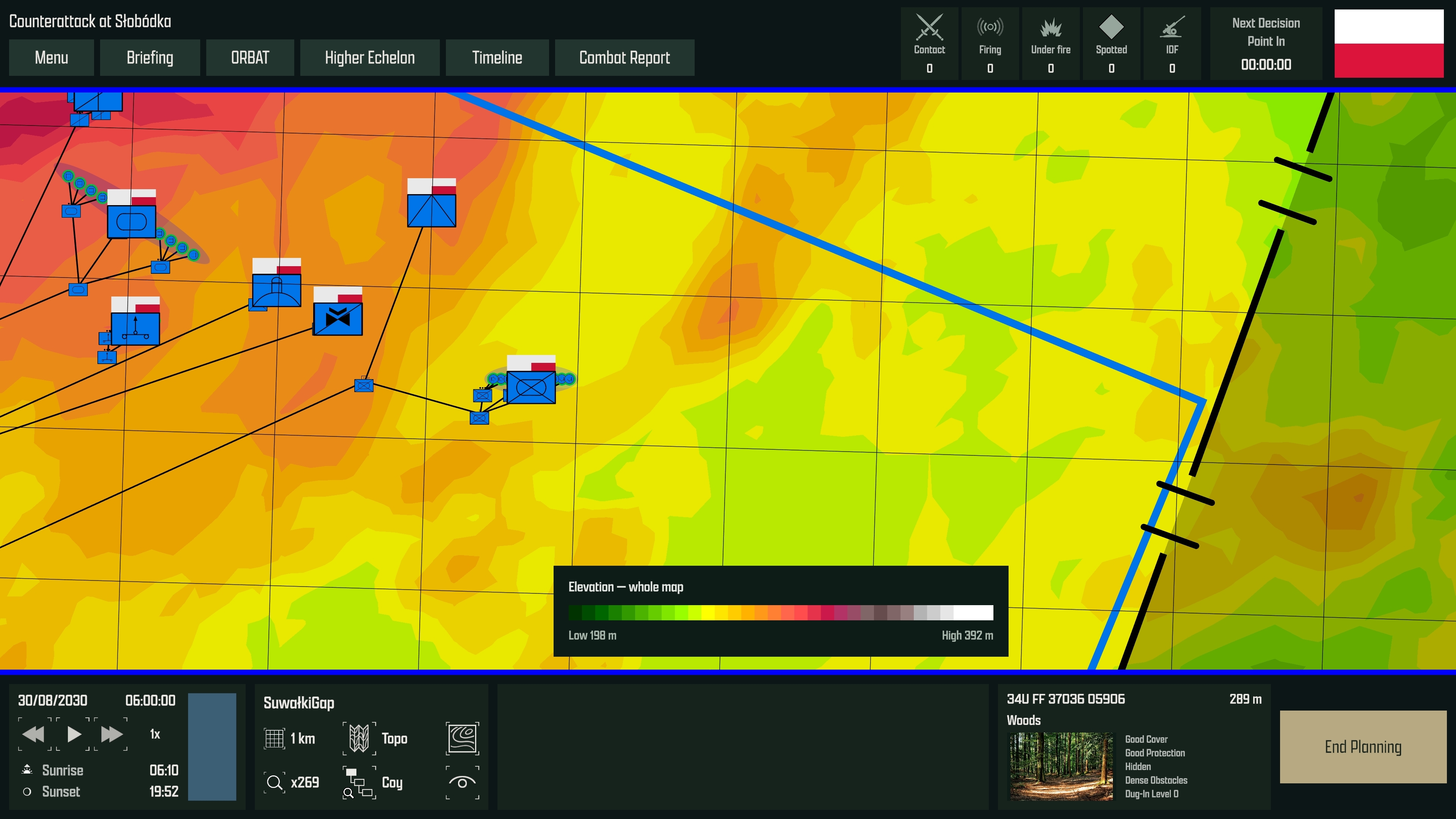
- The global height heatmap shows elevation across the terrain, helping identify major ridgelines, valleys, and areas of high ground.
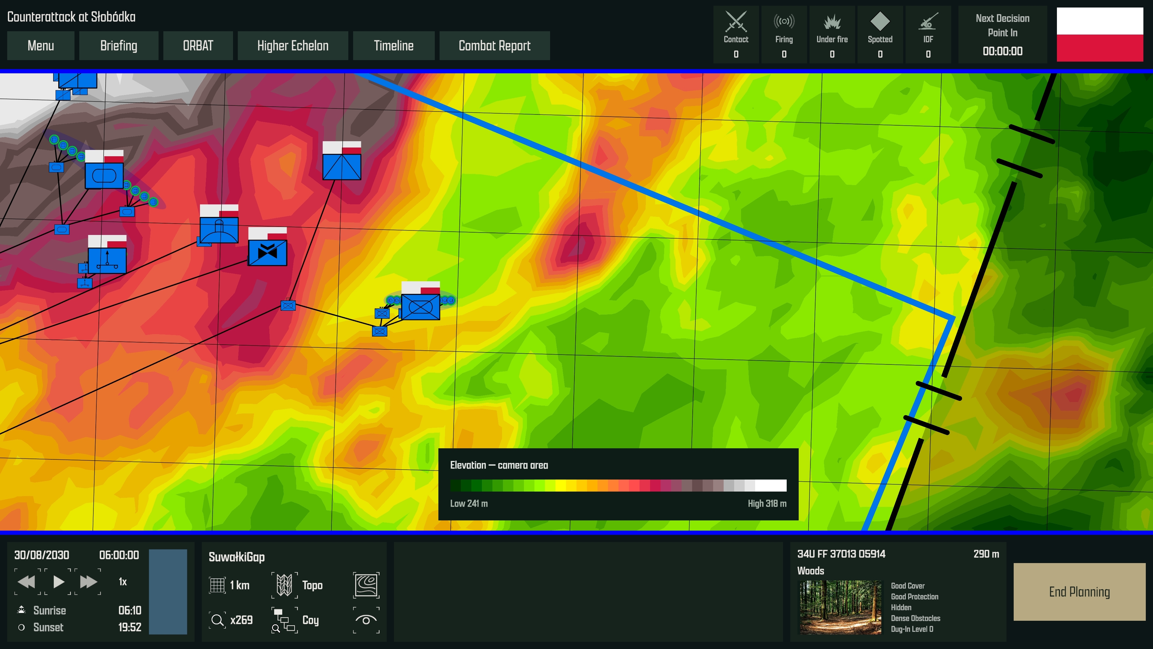
- The tactical height heatmap adjusts to the area currently in view, making smaller local differences in elevation easier to distinguish.
- The slope heatmap helps assess how gradients affect movement, with settings for tracked vehicles, heavy and light wheeled vehicles, and troops on foot.
The tactical height view is particularly useful when choosing an individual position. A hill may be modest compared with the highest ground on the wider map, yet dominate the surrounding village, road junction, or valley. Showing its height relative to the immediate area makes that local tactical advantage much clearer.
Players can also inspect the ground under the cursor to see its classification and characteristics, including any dug-in level.
Line of Sight
Once a potential position has been identified, the line of sight tools allow the player to examine what can be observed from it.
The calculation considers the ground’s elevation, how much woodland the view passes through, the height of the woodland canopy, and the height of buildings. Woodland and buildings also create observation shadows: areas behind them where visibility is reduced or blocked.
Obstruction accumulates along the viewing direction. Several thin belts of woodland can progressively reduce visibility, even when no single belt would completely conceal the ground beyond it. The arrangement of terrain features therefore matters as well as their individual characteristics.
Each unit’s observation capabilities depend on its equipment, including the quality and magnification of its sights. Sensors can also be damaged in combat, reducing detection capability even when a unit remains able to move and fight.
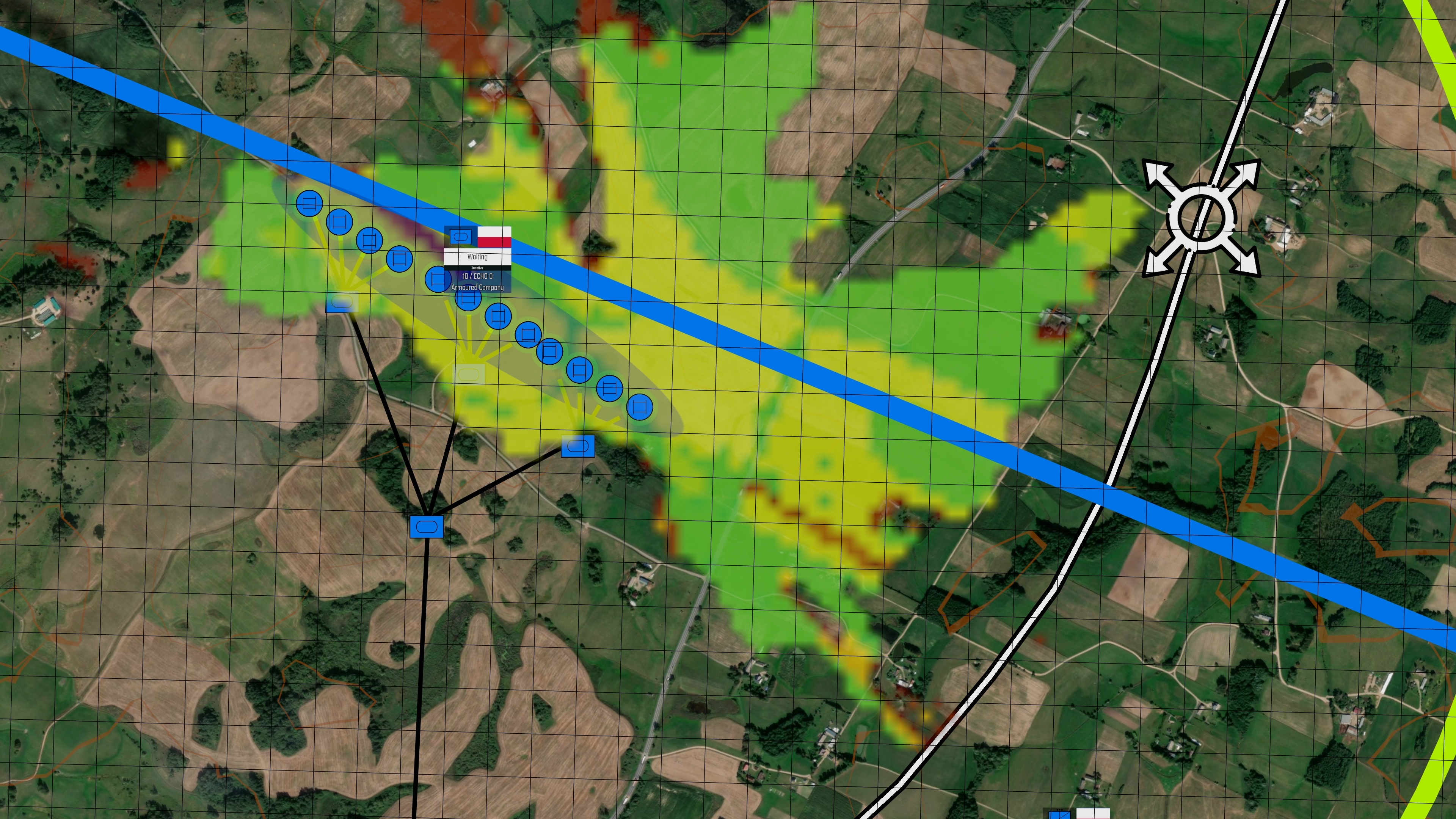
Players can generate an observation overlay from a unit’s current position or preview a selected unit type at a proposed position before moving anything there. Separate modes show eyesight, day sights, thermal imaging, night vision, and radar coverage where the equipment supports them, taking account of the surrounding terrain and current lighting conditions.
These tools help players compare observation posts, position a Support-by-Fire intent, or check whether a defensive position covers the intended approach. The overlay identifies useful observation areas and ground hidden by intervening terrain, while the sensor heatmap indicates how favourable detection is across the area. Actual contact still depends on the target and the conditions in which it is being observed.
My aim is for these systems to give players useful decisions throughout planning and execution, with subordinate commanders making practical use of the ground as they carry out the player’s intent.
As always, I would be very interested to hear what you think.