Command: Modern Operations is coming soon. In this piece, let us take a closer look at how Ground Operations are depicted in CMO.
CMO is not just about massive improvements to UI & UX as we saw in the last two articles. It also includes significant changes and additions to the simulation engine itself. Many of them encompass ground operations, and this week we take a look at them.
The obligatory disclaimer
Let’s get something out of the way up front, which we already stated clearly before but is worth repeating in order to avoid unreasonable expectations.
CMANO has always been about joint, cross-domain operations: ground forces interact with air, naval, strategic and other elements as they execute their mission (the interaction often but not exclusively being of the “shooting at and being shot by” variety). This disciplined focus continues in CMO.
Players expecting CMO to feature the tactical finesse of ground-centered games like Armored Brigade, Flashpoint Campaigns Red Storm, Combat Mission or SPMBT will be disappointed. Troops vs. troops slugging it out muzzle-to-muzzle is doable, but with limitations & abstractions that will likely dismay tactical land combat aficionados. Quick examples: no intricate modelling of per-side armor, no built-in model of suppression & rallying effects (this is doable through scripting if you get creative), not taking advantage of roads, no more than 2 levels of hierarchy etc. So, players who absolutely need these nuances in their wargaming experience should look elsewhere.
Now that we made it clear what CMO does not (yet) provide, let’s see what new and/or improved features it does bring to the table.
The lay of the land
In Command v1.x, the terrain has world-accurate elevation & slope, and this affects both mobility (it’s much easier to traverse a valley than a mountain ridge) and sensor detections (radar & IR clutter). However, the earth’s surface is treated essentially as a global desert: No modifiers for different terrain types affecting mobility and visibility. This changes dramatically in CMO.
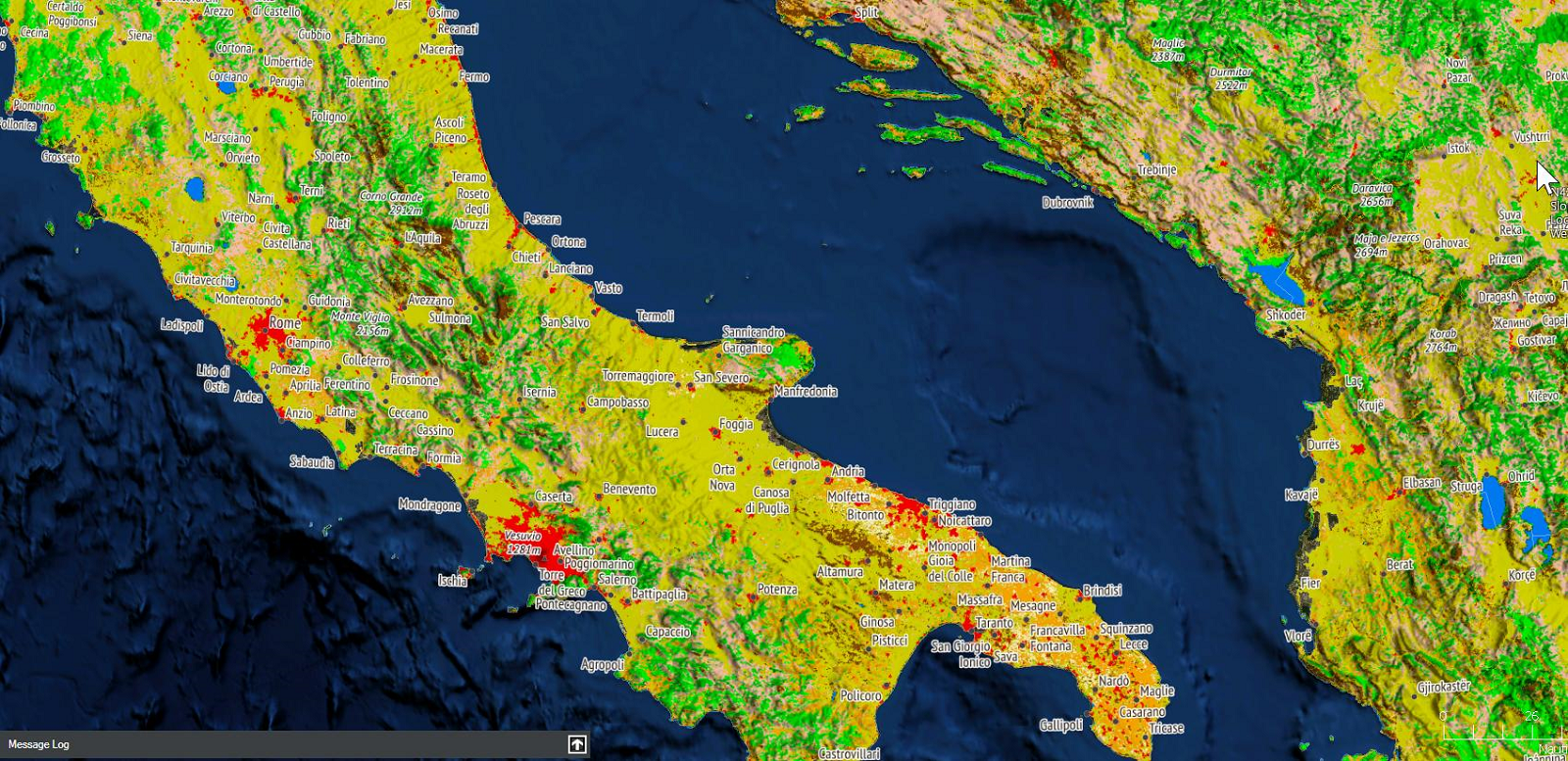
The new “land cover” map layer in action
Terrain type is now a decisive factor in land operations. The various terrain types (urban, desert, forests, croplands etc.) have different effects on the mobility of ground units, on weapon effects (especially blast and frag warheads) and spotting visibility. As examples:
- Water is impassable
- Wetlands reduce speed to 10% of original (bog!), and impair visibility slightly.
- Snow/Ice reduce speed to 20% of original, and impair visibility slightly.
- All forest types reduce speed to 30% of original, significantly hamper the destructive effect of blast and fragmentation detonations, and sharply reduce spotting ranges.
- Shrublands reduce speed to 50% of original, slightly reduce the blast & frag effects, and moderately reduce visibility.
- Croplands and vegetation mosaics reduce speed to 70% of original, and slightly reduce visibility.
- Open and wooded savannas reduce speed to 80% of original
- Barren / sparsely vegetated terrain and grasslands have no impact on speed, weapons or visibility.
- Urban & built-up terrain increases speed to 110% of original, but severely block both weapons and visibility.
These combined effects have startling tactical & operational implications. For example:
- How do you move a unit rapidly and minimizing observation by the enemy? Move it through urban terrain. (If stealth is more important than speed, a forest will also do. If speed is paramount and no urban infrastructure is nearby, go flat-out through barren/plain terrain).
- Do enemy weapons/sensors outrange yours? Deny him a shooting gallery by closing on him through a forest or, failing that, a shrubland. (Conversely: How do you maximize your weapon & sensor standoff? Fight in deserts or plains. Ding ding ding!)
- You know the enemy is holed up inside a forest but your conventional explosive & frag weapons are seriously degraded inside it, and you don’t want to send your own forces inside for a bloody knife-fight. How do you kick them out of the forest? You rain down napalm and fuel-air explosives on their heads. (If civilian casualties are not a concern, this can also apply to urban terrain).
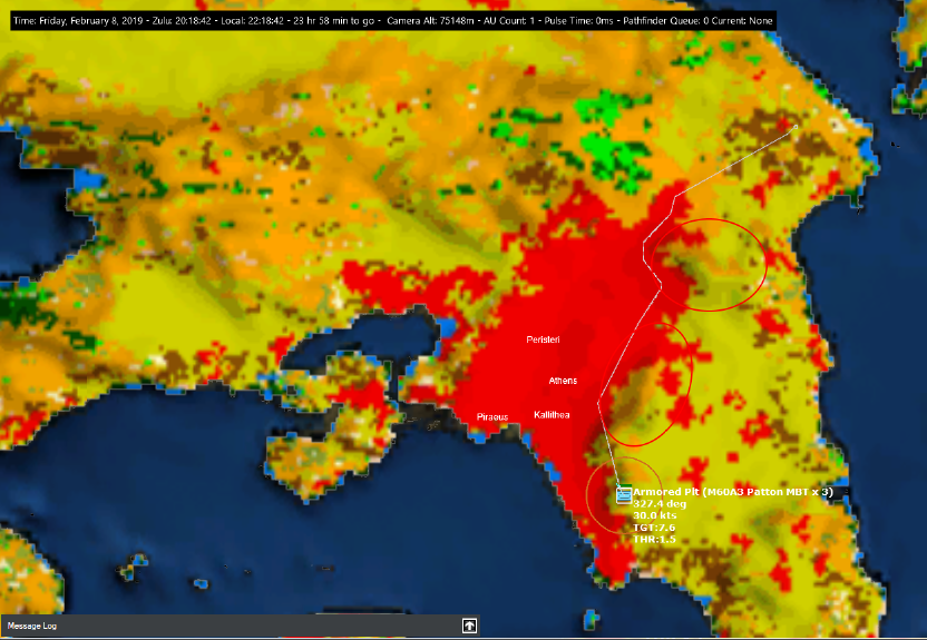
Units are aware of the terrain type and take into account in their navigation & pathfinding calculations. They use a new cost-based pathfinding algorithm that considers both terrain slope and terrain type to generate the optimum (fastest) route to their destination.
In the example below, a M60 tank platoon in southern Attica (outskirts of Athens) is ordered to move to the northeast of the peninsula. The unit selects the displayed path both to avoid the surrounding mountain ridges (red ellipses) and to maximize its mobility, going through the urban area instead of the croplands to the east.
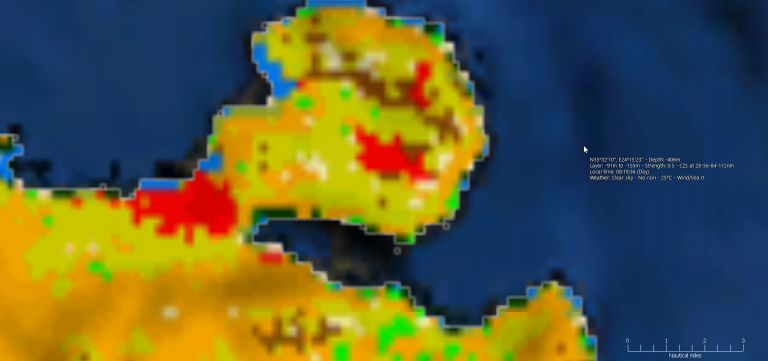
Apart from being visually displayed on the map, the land-type information is also listed on the map-cursor databox, next to the existing terrain slope info:

READ THE FULL ENTRY HERE


