


I have done some minor modifications to the WIR map and put my version out for download.
The changes are:
1) Added the Finnish town of Viipuri (aka Viborg) and the Russian town of Petrozadovsk (but you'll have to put them in with Editwir yourself to get names, population etc. I Viipuri Pop 2, (Initial pop is 0 in 1941 campaign since the town had been conquered by the Soviet Union in 1940 and previously evacuated by Finland) and Petrozadovsk Pop 1.
2) Built a rail line north of the Ladoga. This allows the Finns to reach the Svir river (as they historically did) and capture Petrozadovsk. This also makes it possible to deploy Finnish troops along the Svir in the Setup for the 1942, 43 and 44 campaigns. The rail line wasn't there historically, but obviously the troops on the Svir front got supplied in some manner, and rail is the only way to do it in WIR.
3)Extended the rail lines one hex towards the straits of Kerch from both the Krim and the Caucasus. This means that in the 1943 scenario the Kuban bridgehead is marginally better supplied (not on the first turn though, unless you use the Scenario Editor's Set Map function on the 43 scenario) and that the Soviets can have supplied troops on the entire Kerch Peninsula. In the 1942 scenario, a push by 11th Army to Novorossiysk after the fall of Sebastopol should be feasible (as Manstein considered it to be). This should make the Crimea a little more important.
Download the Modified Map here!
After backing up the original sf.map file, just copy the new sf.map file into your wir directory. You might want to redo the 1942-1944 scenarios putting the Finns on the Svir to begin with.
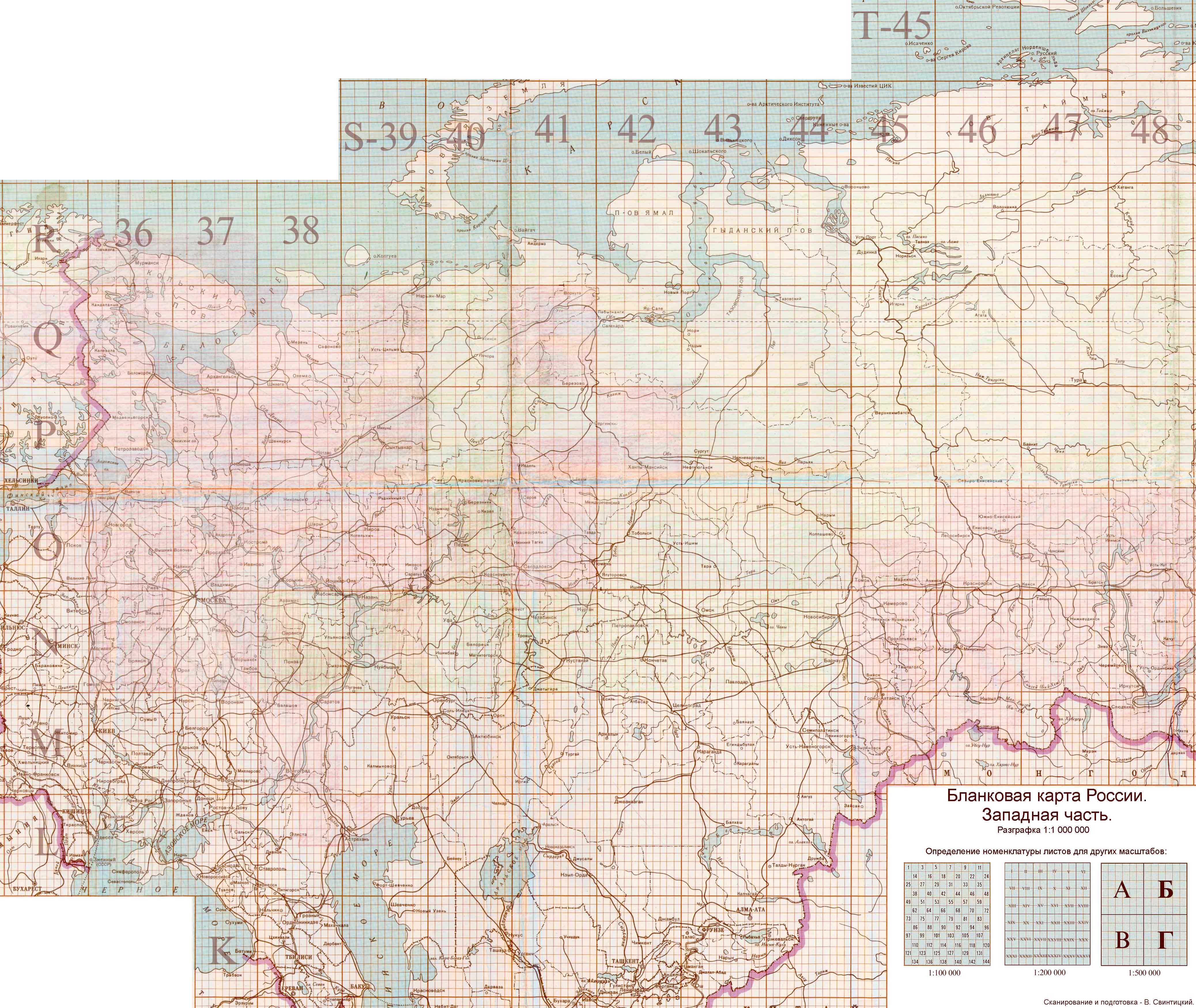
Modified map for download
-
Yogi Yohan
- Posts: 409
- Joined: Fri Jul 28, 2000 8:00 am
- Location: Uppsala, Sweden
- Contact:
Yogi,Originally posted by Yogi Yohan:
I have done some minor modifications to the WIR map and put my version out for download.
The changes are:
1) Added the Finnish town of Viipuri (aka Viborg) and the Russian town of Petrozadovsk (but you'll have to put them in with Editwir yourself to get names, population etc. I Viipuri Pop 2, (Initial pop is 0 in 1941 campaign since the town had been conquered by the Soviet Union in 1940 and previously evacuated by Finland) and Petrozadovsk Pop 1.
2) Built a rail line north of the Ladoga. This allows the Finns to reach the Svir river (as they historically did) and capture Petrozadovsk. This also makes it possible to deploy Finnish troops along the Svir in the Setup for the 1942, 43 and 44 campaigns. The rail line wasn't there historically, but obviously the troops on the Svir front got supplied in some manner, and rail is the only way to do it in WIR.
3)Extended the rail lines one hex towards the straits of Kerch from both the Krim and the Caucasus. This means that in the 1943 scenario the Kuban bridgehead is marginally better supplied (not on the first turn though, unless you use the Scenario Editor's Set Map function on the 43 scenario) and that the Soviets can have supplied troops on the entire Kerch Peninsula. In the 1942 scenario, a push by 11th Army to Novorossiysk after the fall of Sebastopol should be feasible (as Manstein considered it to be). This should make the Crimea a little more important.
Download the Modified Map here!
After backing up the original sf.map file, just copy the new sf.map file into your wir directory. You might want to redo the 1942-1944 scenarios putting the Finns on the Svir to begin with.
Nice job. I respect people like Bill (who did our changes to the map) and you who have the patience to work with the map editor, as it is not easy. The Crimea changes do at least make it possible to do something down on this flank, while the rail line north of Ladoga can really give the Finns a chance to do something, but with their special restrictions on rail/supply it limits it to late in 1941, which is good.
Why don't you post your scenario changes also? Or do you have the room for them? If you haven't made them all and want help, I can make some changes, as it would go pretty quickly.
Looks good.
Rick Bancroft
Semper Fi

Semper Fi
-
Yogi Yohan
- Posts: 409
- Joined: Fri Jul 28, 2000 8:00 am
- Location: Uppsala, Sweden
- Contact:
Originally posted by RickyB:
Why don't you post your scenario changes also? Or do you have the room for them? If you haven't made them all and want help, I can make some changes, as it would go pretty quickly.
I will post the updated scenarios, but I only did the new Finnish deployment in my custom 41 campaign with numerous other changes (unhistorical Axis setup etc) so I have to redo the standard campaigns setups first. Only thing, I totally lack any historical info on what Finnish Korps/Divisions were deployed along the Svir front in 1942, 1943 and 1944, so while it could easily be done and quickly, it would not be historically correct. Any info would be welcome.
I know there are a number of posters from Finland here, so hopefully someone from there (or elsewhere) may have the detail you are looking for. I don't have any details I can find at hand on actual locations of the Finnish corps and divisions after 1941, but there is one possible mistake in the 42 and 43 scenarios, which show the 19th Division present. I have at least one source that indicates this division was disbanded around the end of 1941, but it is also possible it was broken up into its 3 brigades at that point. There were divisions numbered 1-18 except the 9th (which apparently never existed), I believe, but some of these were farther north.Originally posted by Yogi Yohan:
I will post the updated scenarios, but I only did the new Finnish deployment in my custom 41 campaign with numerous other changes (unhistorical Axis setup etc) so I have to redo the standard campaigns setups first. Only thing, I totally lack any historical info on what Finnish Korps/Divisions were deployed along the Svir front in 1942, 1943 and 1944, so while it could easily be done and quickly, it would not be historically correct. Any info would be welcome.
Rick Bancroft
Semper Fi
Semper Fi
-
Yogi Yohan
- Posts: 409
- Joined: Fri Jul 28, 2000 8:00 am
- Location: Uppsala, Sweden
- Contact:
After some research, I found some hard info on the Svir front Order of Battle and prepared a 1942 scenario update with my new map. It is not 100% correct, since two of the Divisions on the Svir (The 4th and 14th) were actually further north.
The 19th Division was indeed disbanded in 1942, but on the other hand a Finnish armoured division was raised that year using captured BT-26's BT-5's and BT-7's.
Download my modified 1942 Scenario. (More to follow).
After backing up your original obfb and obfb.md files, just unzip these into your WIR directory. Have fun!
I've made some changes to the map. They include the changes made by Yogi.
Backup your original sf.map and extract archive in the WiR directory. Do not forget to SET MAP with editwir before starting the game. It will recalculate supply according to new railroads. Have fun!
- Due to my changes it is possible now for supply lines to reach Moscow in min 15 weeks and Rostov in min 16 weeks.
- Narwa Army will not be at SL 0 when Pskov region is liberated by Russians in 1944. It is more historicaly now.
- Added Batumi-Novorossiysk railroad along the western coast of Caucasus.
- Russian armies now will be at max SL of 5 in Caucasus after Stalingrad is conquered by Germans. This is to reflect Stavka efforts to return The City Of Stalin Himself.
- Some swamps and forests are added to the map with a purpose of game balancing, because Germans seem to have a chance of capturing Moscow in 1941.
- Kerch is added to the map as a defensive position in Kerch penissula.
- Added rail hex(instead of swamp) connecting Crimea with Caucasus. Now Crimea will not auto-captured to Germans after the fall of Zaporozhe.
Backup your original sf.map and extract archive in the WiR directory. Do not forget to SET MAP with editwir before starting the game. It will recalculate supply according to new railroads. Have fun!
-
Ed Cogburn
- Posts: 1641
- Joined: Mon Jul 24, 2000 8:00 am
- Location: Greeneville, Tennessee - GO VOLS!
- Contact:
Originally posted by Mist:
I've made some changes to the map. They include the changes made by Yogi.
- Due to my changes it is possible now for supply lines to reach Moscow in min 15 weeks and Rostov in min 16 weeks.
- Some swamps and forests are added to the map with a purpose of game balancing, because Germans seem to have a chance of capturing Moscow in 1941.
Now, I don't want to make a big deal out of this, but I believe you should not "play" with the map to induce balance. The map should be strictly historical. Yogi's addition of the rail line to allow something that was historical is an acceptible compromise, but otherwise, game maps should be as historical as possible. There are other ways to change balance without needing to "fudge" the map.
[QUOTE]
- Due to my changes it is possible now for supply lines to reach Moscow in min 15 weeks and Rostov in min 16 weeks.
Historicaly, Germans captured Rostov and also had a good chance of capturing of Moscow. Rail changes were quite minor(I've made Byalystok-Minsk-Smolensk-Moscow railroad little more straight) and I have used
real 1:1.000.000 map of USSR with main railroads.. You also said that Germans have just not enough time to capture Moscow before bad weather and it's currently barely possible to capture Rostov in 1941.
- Narwa Army will not be at SL 0 when Pskov region is liberated by Russians in 1944. It is more historicaly now.
that's very historical, because there was railroad Riga-Tartu-Narva and it was independent from Pskov.
- Added Batumi-Novorossiysk railroad along the western coast of Caucasus.
Realy. There was railroad Batumi-Krasnodar-Novorossisk.
- Russian armies now will be at max SL of 5 in Caucasus after Stalingrad is conquered by Germans. This is to reflect Stavka efforts to return The City Of Stalin Himself.
Oh, well.. that's ...a "play" with a map
- Some swamps and forests are added to the map with a purpose of game balancing, because Germans seem to have a chance of capturing Moscow in 1941.
well, ok, realy I am going to find good physical map of USSR to verify these changes. But I've added small amount of them.
- Kerch is added to the map as a defensive position in Kerch penissula.
There is not enough place to put all towns on the map. But Kerch penissula is historicaly important.
- Added rail hex(instead of swamp) connecting Crimea with Caucasus. Now Crimea will not auto-captured to Germans after the fall of Zaporozhe.
IMHO it is very historical to make Crimea less dependent from Zaporozhe. Germans must capture it if they want to control it(as it was historicaly). It also makes sence of historical Soviet counteroffensive to liberate Crimea. Probably it would be better to make Crimea supplied by SL 2 after it is being cut off from Ukrain.
-
Ed Cogburn
- Posts: 1641
- Joined: Mon Jul 24, 2000 8:00 am
- Location: Greeneville, Tennessee - GO VOLS!
- Contact:
Originally posted by Mist:
Due to my changes it is possible now for supply lines to reach Moscow in min 15 weeks and Rostov in min 16 weeks.
All I meant was that maps aren't "vague", given the right research material, game maps can be very accurate, and usually are. Combat formulas, and in WiR's case the supply system, are entirely different animals though. Formulas are a hit-n-miss thing, its hard to find the kind of detailed info to test its validity, especially the combat engine used by WiR. Usually you keep tweaking it until you get the general feeling that the results are mirroring history, more or less.
If the Germans can't reach their historical limits, we should tweak the combat formulas, readiness penalties (after all, this is what Gary did to balance things), or supply movement, or maybe better, the rail conversion speed, but the maps I feel should remain accurate, because they are the one thing that we can get close to being historically correct.
Narwa Army will not be at SL 0 when Pskov region is liberated by Russians in 1944. It is more historicaly now.
that's very historical, because there was railroad Riga-Tartu-Narva and it was independent from Pskov.
I didn't question this statement or the others, only the 2 that I quoted.
If these involve adding things such as rail lines where they historically were, that's ok, but adding/changing terrain just to balance the game, or to create an outcome that the game engine fails to cause (which is the fault of the game engine, NOT the fault of the map!), is a mistake, I believe.

Hi people! I've just looked at the map which is included in the manual. It has VERY different railroad net! Somethings differences insignificant, but something historical(and important) has been removed. For example, railroad Romania-Moldova-Ukrain . What were the reasons? It seems to me, that it was removed to "induce" German strategy in 1941 to not attack Ukrain from Romania in June but defend oilfields from Soviet counterattacks. It also prevents any Soviet offensive operations from Ukrain to Moldova-Romania in June-July 1944. It is historical, but this "historicity" is induced by the abcence of historicaly existing railroad.
-
Ed Cogburn
- Posts: 1641
- Joined: Mon Jul 24, 2000 8:00 am
- Location: Greeneville, Tennessee - GO VOLS!
- Contact:
Originally posted by Mist:
Hi people! I've just looked at the map which is included in the manual. It has VERY different railroad net! Somethings differences insignificant, but something historical(and important) has been removed. For example, railroad Romania-Moldova-Ukrain . What were the reasons? It seems to me, that it was removed to "induce" German strategy in 1941 to not attack Ukrain from Romania in June but defend oilfields from Soviet counterattacks. It also prevents any Soviet offensive operations from Ukrain to Moldova-Romania in June-July 1944. It is historical, but this "historicity" is induced by the abcence of historicaly existing railroad.
The map in the manual is the original one, the map distributed in the game now was modified by Bill who is still on the testing group ml.
To me, the rule should be simple: If the rail line really existed, then it should be on the map, regardless of what "problems" that might create. The "problems" are created by a flawed game engine, not the map.
Post your map with the new rail line mentioned above added. I'd like to see your version.
-
Yogi Yohan
- Posts: 409
- Joined: Fri Jul 28, 2000 8:00 am
- Location: Uppsala, Sweden
- Contact:
Bill used a few different sources on the changes that he made, and I don't believe any of them were designed to "force" the play to be historical. I know he relied on a few boardgames in part for his changes, including War in Europe by SSI. If I remember right, this map does not show the more direct route from Rumania to the southern Soviet Union, but I haven't played that game in 15 years or so, so I could be wrong.
I do have another game - Fire in the East/Scorched Earth by GDW that shows the rail line that Yogi is talking about and also shows some kind of transportation line (could be a road or a poor railroad in their mind) running basically along the route of Mist's map. In the designer notes for this game, they mention that there were numerous low grade (single track) rail lines throughout the Soviet Union that they did not display, or were sometimes related to the above "transportation" lines that were not suited for military use because of the lack of sidings for long distances limiting the traffic to one direction. They said many of these lines were not used by the Germans anyway because of the limited use and partisan attacks, and after years of neglect the Soviets couldn't put many of them to use either.
Anyway, there are some questions as to which railroads should be represented, as putting every one of them on the map, especially as it creates clear terrain in the hex, is not workable or even historically correct for some actual rail lines that were not used. In this case, I would agree that this railroad should be on the map, but in some cases they must be left off or there would be parallel rail hex 2 deep in some spots.
Rick Bancroft
Semper Fi
Semper Fi
-
Yogi Yohan
- Posts: 409
- Joined: Fri Jul 28, 2000 8:00 am
- Location: Uppsala, Sweden
- Contact:
I have two more sources confirming that the direct Odessa-Bucharest route was either not there or not in working order (Apart from my 1961 vintage atlas).
* Alan Clarke's Barbarossa, Map for chapter "Slaughter in the Ucraine". The beggining of the line going to Kisjinov is shown (due NW from Odessa) but nothing going W or or SW.
* Richard Natkilel's "War Maps:Campaigns and battles of WW2", Map for chapter "Regaining the Ucraine". Again, Odessa-Kisjinev is there, but not the more direct route from Mist's map.
I think we can conclude that there should NOT be any direct rail link from Odessa to Bucharest in WIR.
Yogi! Thanx for info. This subject deserves special attention. Just note that some maps do not show existing railroads. For example,
I have a book "Stalingrad Battle" of A.Samsonov. It contains very good maps which include railroads of 1942-1943. I was astonished when I didn't find railroad Rostov-Stalingrad.There were NO railroad shown leading east to Stalingrad. Only Rostov-Millerovo-Voronezh railroad. But further maps study showed that this railroad is still shown on other closer scale maps. BTW: if I am not mistaken, railroad Odessa-Kishinev-Romania is being shown in this book on the USSR map. I will check it today.
I have a book "Stalingrad Battle" of A.Samsonov. It contains very good maps which include railroads of 1942-1943. I was astonished when I didn't find railroad Rostov-Stalingrad.There were NO railroad shown leading east to Stalingrad. Only Rostov-Millerovo-Voronezh railroad. But further maps study showed that this railroad is still shown on other closer scale maps. BTW: if I am not mistaken, railroad Odessa-Kishinev-Romania is being shown in this book on the USSR map. I will check it today.
-
Yogi Yohan
- Posts: 409
- Joined: Fri Jul 28, 2000 8:00 am
- Location: Uppsala, Sweden
- Contact:
Agree. I have two ideas for tweaks, but I don't know how hard they would be to implement:Originally posted by Ed Cogburn:
Now, I don't want to make a big deal out of this, but I believe you should not "play" with the map to induce balance. The map should be strictly historical. Yogi's addition of the rail line to allow something that was historical is an acceptible compromise, but otherwise, game maps should be as historical as possible. There are other ways to change balance without needing to "fudge" the map.
Regarding rail conversion, how about assigning a small number (2-3 or so per turn) of extra conversion "builds" to the axis player during the Blitzkrieg phase turns, that he could manually allocate during his turn to damaged rail hexes adjacent to undamaged ones and instantly repair. This would allow somewhat faster movement in one or two directions without completely unbalancing the game.
Regarding the Crimea, if the Special supply hexes could add supply to adjacent hexes in the same way that rail does, the problem would be solved. As it is now, Sebastopol will be at supply 5 and adjacent hexes at supply 0.
Yogi! I've checked mentioned above book. There is two railroads from Kishinev which are going 1) west to Karpats 2) SW to Romania and Bukharest. Kishinev is connected with Odessa by railroad going south-east-east. The map that I am reffering to, shows almost all of european part of the USSR and contains only main rail lines because there were no reasons to put secondary or unused railroad on this map. I think my version of railroad can possibly be good compromise betweet straight Constanta-Odessa railroad and the abcence of rail at all.
Full reference: Academician A.M.Samsonov, "Stalingrad Battle", pp. 48-49, Nauka,1983
Though, I can accept your version Yogi! I agree with this railroad, but it looks a bit "not pretty".
[ April 18, 2001: Message edited by: Mist ]
Full reference: Academician A.M.Samsonov, "Stalingrad Battle", pp. 48-49, Nauka,1983
Though, I can accept your version Yogi! I agree with this railroad, but it looks a bit "not pretty".
[ April 18, 2001: Message edited by: Mist ]
I agree Ricky! I did not expect that kind of difficulties, when I decided to test WiR railroad map. So, I had put rail hex here and there and everywhere in central USSR where I succeeded to find it on my maps. The result was going to be railroads everywhere, so I changed my mind. Now I think, that rail hex must be on the WiR map either if railroad was used by Germans/Russians extensively, or if it is shown on the map as a main strategical railroad in the area. Good example is Rostov-Stalingrad railroad which I had mentioned above. Another example is railroad Batumi-Krasnodar-Novorossisk. Though it is not presented on WiR map, but Hitler's directive N45 included intention to attack Batumi along the western coast of Caucasus. So there can not be only mountain hexes on the WiR map and no railroad at all in this strategical direction.Originally posted by RickyB:
Anyway, there are some questions as to which railroads should be represented, as putting every one of them on the map, especially as it creates clear terrain in the hex, is not workable or even historically correct for some actual rail lines that were not used. In this case, I would agree that this railroad should be on the map, but in some cases they must be left off or there would be parallel rail hex 2 deep in some spots.